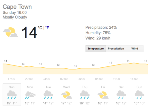
Several weather advisories have been issued for various parts of the country over the past week, including warnings of snow and localised flooding for this weekend.
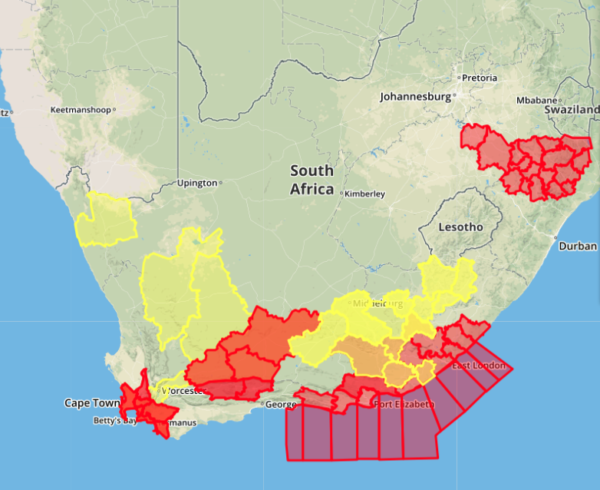
Storm warnings have been issued for many regions along the country’s coast, including Betty’s Bay and Hermanus.

Areas highlighted in red will experience “disruptive or disastrous” weather conditions within the next 24 hours, while areas in yellow have five days before extreme weather conditions hit.
“The prospect of rain for the Cape provinces later this weekend will surely be welcomed, although the quantity thereof will be fairly conservative. Cold, windy and showery conditions will spread across the southern half of the country by Monday,” SAWS said in a statement. “The mid to late winter months of June and July are typically the time of year when one can expect more intense, well-defined frontal systems, typically with the potential to bring snow, bitter cold and good rainfall to parched and largely drought-stricken parts of the Cape provinces.”
A recent trend of smaller cold fronts hitting simultaneously has also been noted by SAWS. “In particular, the South African Weather Service (SAWS) would like to alert the general public regarding the expected arrival of a cold frontal system over the south-western part of Western Cape from Sunday afternoon, June 30, onwards.”
Cold, windy and rainy weather is predicted set in over the Western and Northern Cape in the latter half of Sunday, spreading eastwards into Eastern Cape, the Free State as well as southern KwaZulu-Natal on Monday.
“The impact of rainfall (especially with a view to the risk of flash flooding or localised flooding) is not expected to be of particular concern with this weather system, although isolated incidents may still occur. However, the combination of very cold, wet and windy weather, expected over a significant portion of the interior on Monday, especially the sudden onset thereof, is a feature for farmers to take note of, especially small stock farmers. After the passage of the cold front, the minimum temperature overnight for the central interior is expected to fall below -5°C in the early morning hours of Tuesday. Such low, sub-zero temperatures imply a significant risk of frost, hence vegetable farmers and nursery owners should take heed. Similarly, birds and small animals on farms and at rescue centres (e.g. SPCA) would also be at risk of hypothermia. The public are therefore advised to take necessary precautions,” the weather watching service said.

The recent rains have bolstered the Cape’s dams, bringing the average dam level up to 50.5%.
Last year this time, dams were at 42.2% – a difference of over 7%.
Picture: Pixabay

