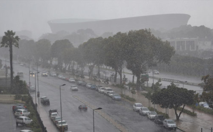
Be warned Capetonians – it’s going to be wet and wild on Thursday.
The use of the term ‘warm-up’ may read like a contradiction but we’ve been here before in the past month and another big cold front will beat at the heart of autumn in the Western Cape late on Wednesday night and into Thursday.
In the last month, the Western Cape has taken a few wet beatings, which has raised the dam levels to nearly 70 percent, but the weather has also typically put lives at risk and destroyed homes.
The weather warning for Thursday is one of flooding in certain areas and also one of caution for those on the roads.
Drive safe, be safe and look out for each other.
The Minister of Local Government, Environmental Affairs and Development Planning Anton Bredell told IOL the bulk of the rainfall is expected to occur mostly on Thursday morning into the afternoon, with continuous showers into Friday,
ALSO READ: Cape dam levels up by 1.2%
The wet-weather precautions, as widely reported on media outlets and consistent with each Cape Storm preview, include:
- Clearing of stormwater channels in lower-lying areas.
- Placing of sandbags at high-risk locations.
- Installation of silt curtains in strategic locations.
- Clearing of stormwater inlets in Rhodes Avenue from Rhodes Drive to Woolsack Drive, and along Philip Kgosana Drive towards Vredehoek.
- Excavation of earth channels along Philip Kgosana Drive.
- Repair work to damaged guardrails along the M3.
- Construction of temporary weirs with sandbags and poles.
*The emergency number to call is 112. It is a toll-free number.
Other regional emergency numbers in the Western Cape are:
- City of Cape Town – 107 or 021 480 7700 and 080 911 4357
- Overberg – 028 425 1690
- West Coast – 022 433 8700
- Garden Route – 044 805 5071
- Central Karoo – 023 449 8000
- Cape Winelands – 021 886 9244 / 021 887 4446.

