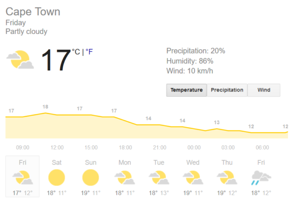
Cape Town has been experiencing some chilly weather over the past week, and even more cold days are expected. It’s going to be a rainy start to the weekend, with forecasts predicting more showers throughout Friday and a windy Saturday.
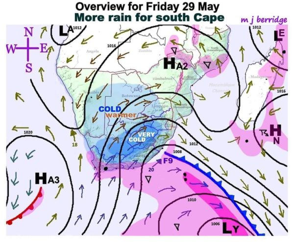
According to popular forecaster Mike Berridge, Cape Town’s weather will experience some changes over the weekend.

“”F9” is the latest front to skirt the south cape coastal region yielding no rain inland. (It is NOT the same system as “F8” of two days ago). So light to moderate rain will therefore continue there today [May 29] (pink shading), moving eastward out into the sea overnight. The anti-cyclone “HA3″ will quickly take over the territory and establish off shore winds tomorrow [Saturday, May 30] blowing away all rain from the Cape,” says Berridge.
A number of areas are in for some very cold temperatures, with frost expected to hang around in others.
“Temperatures overland will gradually increase in very dry air, so frosts remain possible in the cold zones – as expected at this time of the winter season. It must be realised that the borders of the cold zones cannot be sharply defined, but more resemble transitional edges in which temperatures gradually change, influenced by local topography (and the lay of the land). In central Mozambique, a weak upper Low will assist some shower development in moist air moving in from the sea. The affected provinces are mainly Tete and Zambezia,” adds Berridge.
According to Weather.com, Cape Town is in for a slightly sunny weekend, with cloudy condition returning next week and more rain expected closer to next weekend again.

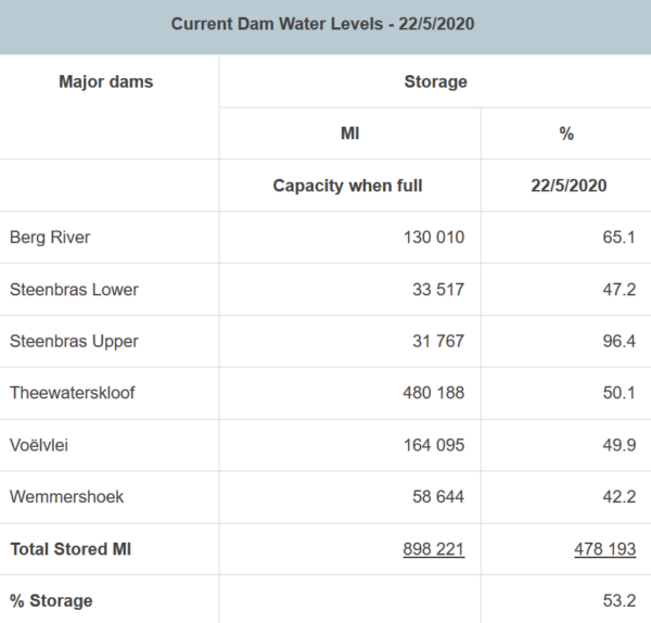
Dam levels are well above the 50% marking, at 53.2% as of May 22. Updates on the levels are expected to reflect improvement as the rainy weather continues in the Mother City.
Our fullest dams are Steenbras Upper at 96.4% full and Berg River at 65.1%.

Pictures: Supplied/Unsplash/The City of Cape Town

