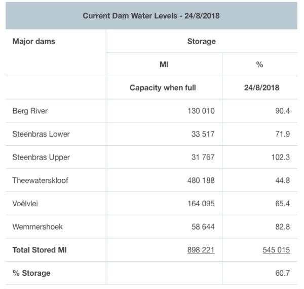
This week, for the first time in 18 months, the dam levels pushed past the much anticipated storage capacity of 60% and the good news continues as levels keep rising.
Storage officially increased from 60.1% to 60.7% today, and more rain forecast for the weekend is expected to replenish the water supply even more.

South African Weather Services released a warning today, notifying residents to be weary near coastal areas due to high seas, gale winds and heavy rainfall that could cause flooding as well as very cold conditions.
Afternoon satellite image (24 August 2018). Cloudy in the extreme east with isolated showers and possible isolated evening thunderstorms on the Highveld. Fine and cool to warm for the remainder of SA. Cold front expected to reach the Western Cape tom (Sat) late afternoon. pic.twitter.com/jVE2CmGsCT
— SA Weather Service (@SAWeatherServic) August 24, 2018
Please be advised about the following for 25-26 August 2018. Strong #coldfront expected in the Western Cape. pic.twitter.com/QCSGIgXO1C
— SA Weather Service (@SAWeatherServic) August 23, 2018
Although weather is expected to be particularly rough this weekend, hopes are that it will greatly benefit the catchment areas.
Picture: Twitter

